

Blakely Harbor Park
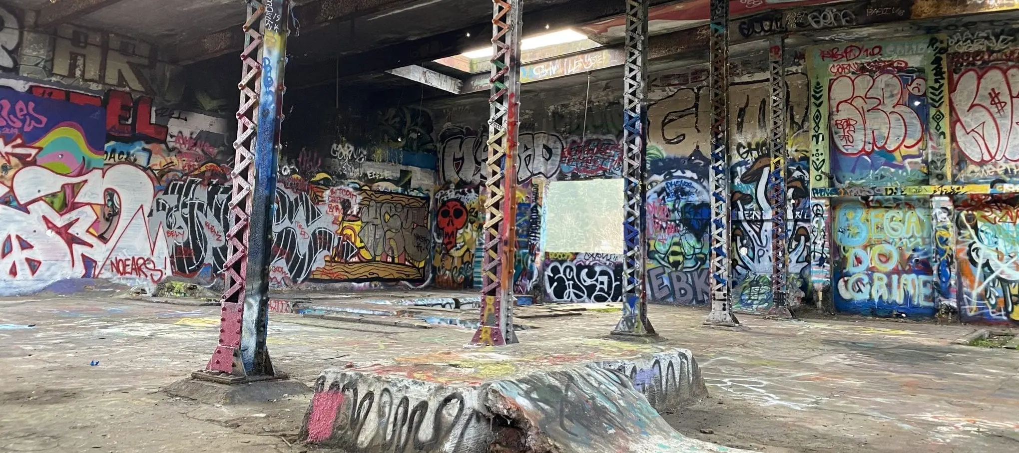
Blakely Harbor sits on the old Port Blakely mill — once one of the world’s largest sawmills, now 40 acres of beach, kayak put-in, and a graffiti-covered generator ruin. Mill history is the point. The paint is extra. Stay off the unstable concrete.
South end. Not a walk from the ferry. Island-wide clocks: visitor guide.
At a glance
Address
Blakely Avenue and 3-T Road. 40 acres on the harbor.
From Winslow
A south-end drive. Not a walk. Car, or a booked ride.
Do
Beach, picnic, kayak put-in, wildlife. Photograph the ruin. Do not climb it.
How long
45 minutes to two hours. Tide matters if you want beach, not just the building.
Maps
Park District printable maps: biparks.org.
Directions
Address and map: Blakely Harbor listing. This page is how to visit.
The generator is a ruin, not a jungle gym.
Unstable concrete. Stay off it. The photo from the beach is the one you want anyway.
Mill, graffiti, Yama
In the late 1800s Port Blakely Mill was one of the world’s largest sawmills. It closed more than seventy years ago. Nature took most of it back. What remains is shoreline, woods, and a painted generator building that shows up in photos. Come for the harbor and the mill story; treat the paint as extra. Do not climb the ruin — the concrete is unstable.
Yama is the seven-acre piece that was the Japanese mill town in the Port Blakely era — homes, baths, a community on this harbor long before the Exclusion Memorial went up at Eagledale. It is an archaeological site, not a playground. Walk it with that in mind. The longer Japanese American story is the Exclusion Memorial, a different ride.
You can launch a kayak or canoe here. Bring your own, or rent in town from Back of Beyond. This is not a guarded swim beach.
Getting there from the ferry
The Seattle ferry lands you in Winslow. Blakely is south, past Lynwood. There is no tourist bus. Book BI Ride only if they will take this address — it is not the Lynwood connector’s main stop. A taxi, Uber, Lyft, or a car is the honest plan.
What else that day
Natural pair: Lynwood Center for food after, or Rockaway Beach if you want the stairs and the Seattle view. Fort Ward is the next shoreline south. One harbor, then dinner. Not five parks.
The Explore Bainbridge app
Live ferry, map from the dock, itineraries. Free. Download it on the boat. explorebainbridge.com.


FAQ
Where is Blakely Harbor Park?
Blakely Avenue and 3-T Road, south end, 40 acres on the old Port Blakely mill. Not a walk from the ferry.
Can I climb on the graffiti building?
No. The generator ruin is photogenic and unstable. Stay off the concrete. Mill history is the point; the paint is extra.
What is Yama?
The seven-acre portion of the park that was the Japanese mill community in the Port Blakely era. Treat it as a historic site, not a playground.
Can I kayak here?
Yes — human-powered put-in is part of the park plan. Bring your own boat or book a rental elsewhere. This is not a guarded swim beach.